Tijeras Creek Remediation Project
Click here to view photos from the Tijeras Creek Remediation Project!
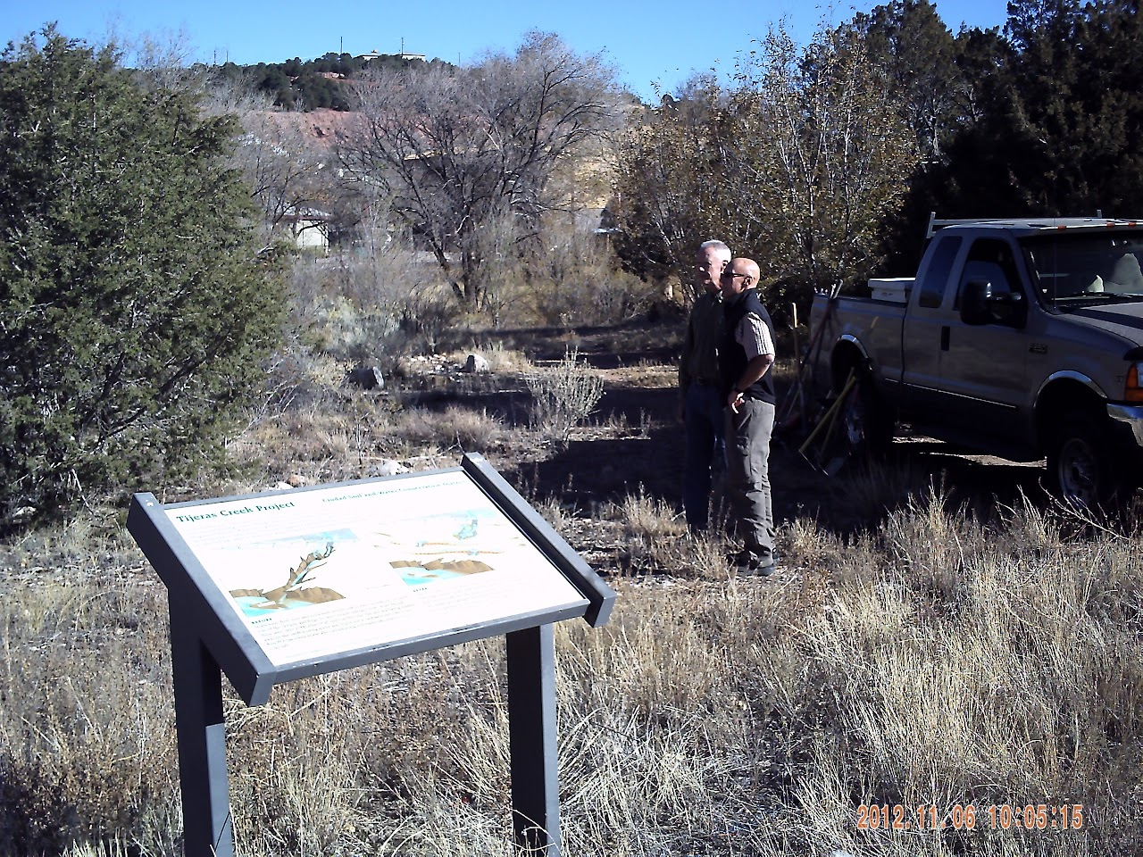
With funding provided by the NM Soil and Water Conservation Commission, and in-kind assistance from Bernalillo County, Ciudad SWCD in late 2012 worked with Adaptive Terrain Systems, Inc. to rehabilitate the Tijeras Creek Project. The rehabilitation project re-established the stormwater detention and erosion reduction functionality of the facility. Please see above for photos of the rehabilitation project. Pertinent documents can be viewed and downloaded at the end of this page.
Read a Querencia Green blog about the Tijeras Creek Project!
View Power Point slides from an October 2014 presentation by Jim Brooks, Adaptive Terrain Systems, at the NMASLA Innovations in Stormwater workshop, featuring the Tijeras Creek Project!
Read and download a Tijeras Creek Restoration Project Site Guide produced by Master Naturalist Rick Hada.
Tijeras Creek is a small but important intermittent (once perennial) stream that carries water from the east flank of the Sandia Mountains to the Albuquerque Basin, where it sinks into the sandy soil to eventually recharge the aquifer from which the city draws its water supply. The creek flows through the Village of Tijeras, which has experienced significant growth in recent years. That growth brought new buildings for a library, post office, and businesses, as well as expanded community center and school buildings, with their associated parking lots and playgrounds.
When rain or snow falls on forest or grasslands, most of it tends to soak into the ground. It becomes available to plant roots and microorganisms living in the soil, freeing up nutrients for the trees and shrubs, grasses, and wildflowers. Excess water runs off toward the lowest point, usually an arroyo or stream.
Urbanization - the change from a natural environment to a man-made setting with buildings and pavement - leads to changes in the natural areas that remain. Runoff from roofs and roadways doesn't have as much opportunity to infiltrate. The resultant larger volume of surface water collects and flows over the landscape faster than it did before, picking up pollutants like oil and salt from the roads. The higher, faster flows coming off the pavement have enough force to wash away soil particles once they reach unpaved ground, creating gullies that funnel ever more pollutant-laden runoff towards the stream.
This process can be seen along a reach of Tijeras Creek north of the A. Montoya- Roosevelt campus. Runoff from the schools' roofs, parking lots, and playground flows to several drains that empty into the riparian (riverside) area. During summer monsoons, the flows are strong enough to erode deep gullies, despite the abundance of vegetation near the creek. This runoff carries sediment and other pollutants to Tijeras Creek. Increased runoff from urbanized areas up and down the creek multiply the effect, leading to bigger floods, more erosion, and lower water quality overall.
In the mid-1990s, A. Montoya Elementary School had an immediate problem with water from the roof undermining the building foundation and washing the soil across the sidewalks and driveway. The Ciudad Soil and Water Conservation District installed a natural water harvesting system that catches the runoff before it can cause damage, and uses it to water some landscaping in front of the main building. We were able to solve the problem by treating the water as an asset instead of a liability. The Tijeras Creek Project applies the same conservation principles to the campus as a whole, helping the community work toward keeping our natural resources healthy in an urban environment.
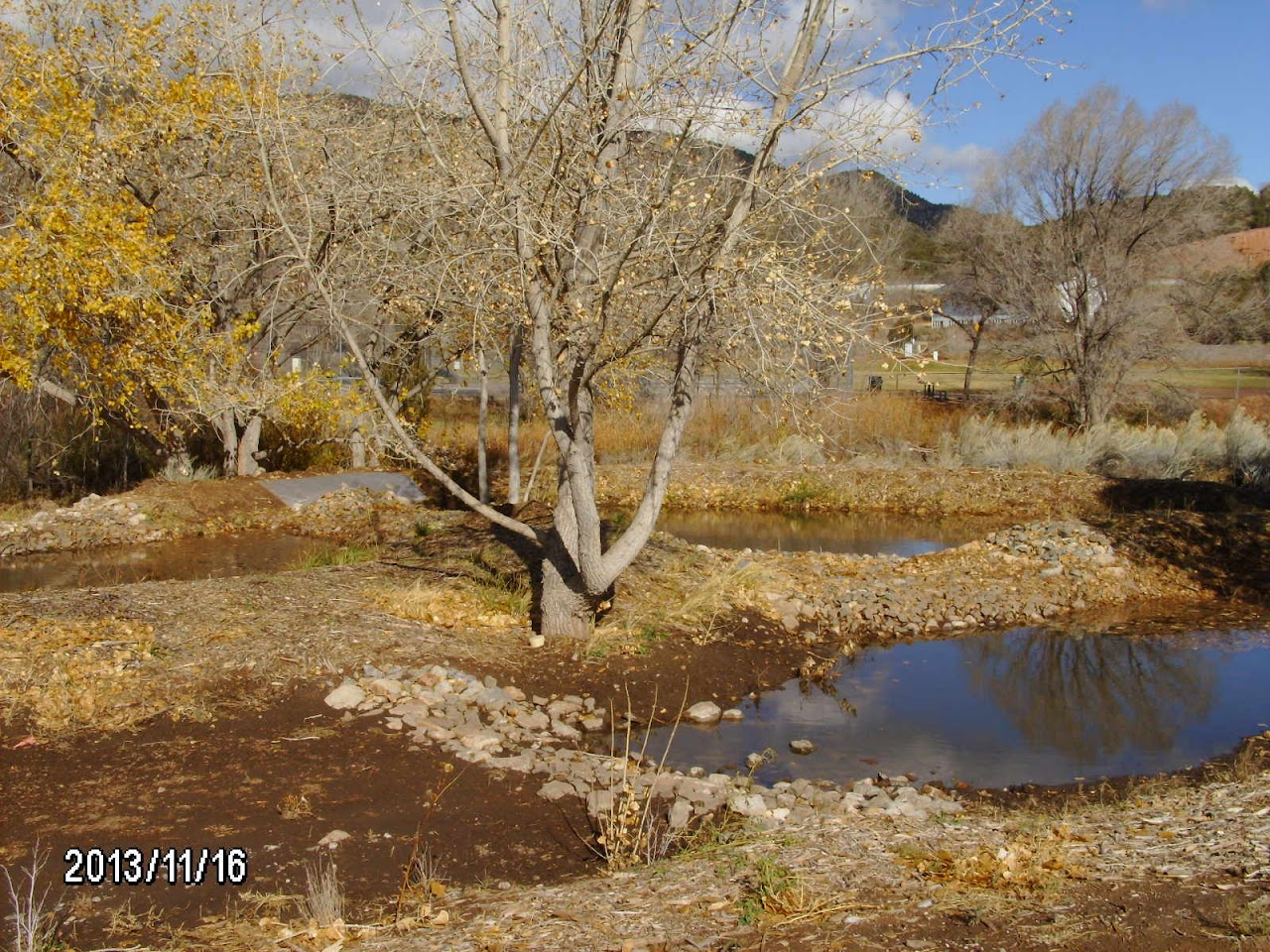
The Tijeras Creek Project demonstrates methods that can be used to slow the flows leaving the school grounds and filter out pollutants from the runoff. Structures such as stilling basins (small ponds with protected bottoms) at the drain outlets and swales (shallow, nearly-level trenches) have been combined with replacement plantings, reshaping eroded areas and enhanced infiltration to allow as much water as possible to soak into the soil within the riparian zone. The runoff that reaches Tijeras Creek now flows slower and cleaner again, much like it did before urbanization.
The project site, north of the A. Montoya-Roosevelt school campus, serves as an example of the methods (called "Best management Practices", or BMPs) used to solve these problems. The project implements portions of the 2004 Tijeras Creek Watershed Restoration Action Strategy. Principles demonstrated in the project can have widespread impact, as many streams in New Mexico flow through increasingly populated urban areas.
Initial construction of the Tijeras Creek Project occurred in 2002. Initial funding and oversight were provided by the New Mexico Environment Department, the U.S. Environmental Protection Agency, through the Clean Water Act Section 319(h) grants program. The Natural Resources Conservation Service provided technical assistance. Over the ensuing decade, lack of ongoing maintenance resulted in degradation of the structures and regrowth of invasive Siberian elms within the project boundaries, undermining its effectiveness.
What is the Tijeras Creek Remediation Project?
In the canyon east of Albuquerque, along Tijeras Creek, are reaches where storm water causes problems such as increased flooding, pollution, and erosion. The Tijeras Creek Demonstration and Education Project is designed to treat one of those areas to reduce the impacts of urbanization on the riparian (streamside) environment and on the creek itself. The site, near the A. Montoya-Roosevelt school campus, will serve as an example of the methods (called "Best management Practices", or BMPs) used to solve these problems. The project could have widespread impact, as many streams in New Mexico flow through increasingly populated urban areas. The project implements portions of the 2004 Tijeras Creek Watershed Restoration Action Strategy.
Who sponsors the project?
The Ciudad Soil and Water Conservation District is the project coordinator. The conservation district is directed by a board of local citizens knowledgeable about natural resources in Bernalillo and Southern Sandoval Counties. Funding and oversight are provided by the New Mexico Environment Department, the U.S. Environmental Protection Agency, and the state Soil and Water Conservation Commission. Natural Resources Conservation Service provides technical assistance.
What will the project accomplish on the ground?
Ciudad is installing several kinds of structures between the school parking lots and Tijeras Creek. These structures are designed to slow down the storm water leaving the school property enough to allow much of it to soak into the ground and keep it from eroding the stream banks. We are creating special areas where the soil, plants, and microorganisms in the ground can work together to filter out pollutants carried in the runoff. At the same time, we remove some of the invasive plants such as Siberian elm and toadflax, and replace them with native species of trees, shrubs, grasses, and wildflowers. The site will be able to be used for class field trips to learn about the local ecology.
What is the "education" part of the project?
District staff works with the schools to involve children in the project. Students participate in outdoor activities like water sampling, measuring ground slope, planting, and wildlife inventories. Students will learn the "hows" and "whys" during class time using lesson plans developed for this project. We also hold tours of the site and workshops to demonstrate how the BMPs do their job of protecting the creek. Signs near the site will describe the project to passers-by.
Who can I contact for more information?
Call the Ciudad SWCD at (505) 510-DIRT.
Click here to open the Tijeras Creek Project documents folder.
Here are links to downloadable project files:
2003 Tijeras Creek Project Area Diagram
2012 Tijeras Creek Project Area Diagram
Tijeras Creek Retention Diagram
Tijeras Creek Straw Bale Diagram
Tijeras Creek Spillway Diagram