
Maps and Boundaries
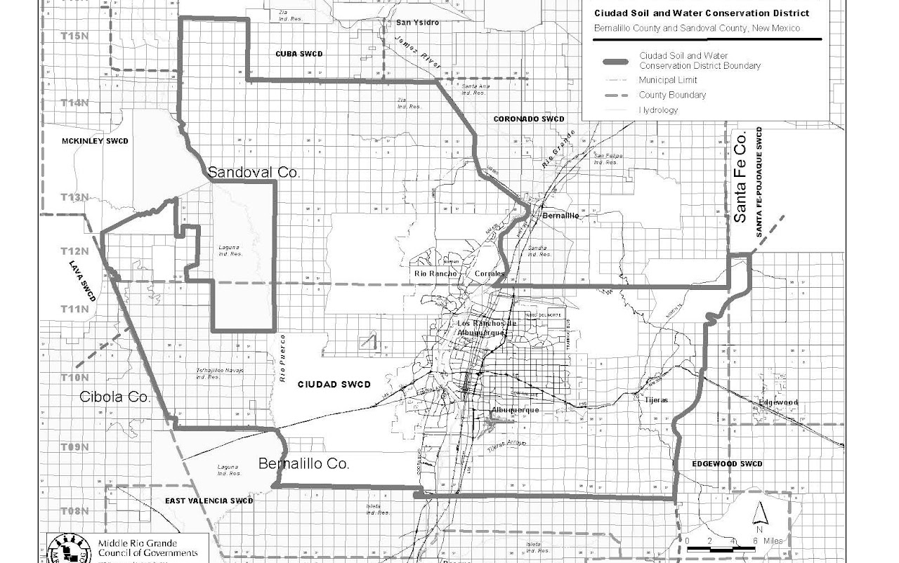
The Ciudad Soil & Water Conservation District (SWCD) encompasses most of Bernalillo County and part of Southern Sandoval County, and includes approximately 918,000 acres of land. Approximate boundaries are the Laguna Indian Reservation on the west, Isleta Indian Reservation on the south, State Highway 217 on the east, and State Highway 550 and the Bernalillo/Sandoval County line on the north and northeast. The cities of Albuquerque and Rio Rancho, multiple Land Grants, and the villages of Corrales, Los Ranchos, Tijeras and other East Mountain communities are all located within our District's boundaries. Tijeras Canyon, which bisects the two mountain ranges via I-40 and Route 66, acts as the gateway between eastern plains and the Rio Grande Valley.
A traveler going west to east across the District would pass from the arid Rio Puerco valley across sand hills and lava-capped mesas to the Rio Grande Bosque. They'd then climb eastward across undulating alluvial fans, up the piñon and juniper-covered foothills to the rocky cliffs at the top of the Sandia and Manzano mountains. From their crest, the land descends through wilderness and mixed conifer forests down to more piñon/juniper and finally reaches open grasslands on the edge of the Estancia Basin. Approximately 13,700 acres have irrigation water rights, but the amount of this area actually used for irrigated agriculture is being reduced by commercial and residential development. Most irrigated land utilizes river water diverted from the Rio Grande through the canals and laterals of the Middle Rio Grande Conservancy District.
Farms and rangeland in the valley and on the mesas have been replaced by urban development in and around Albuquerque and Rio Rancho. Outlying areas on the West Mesa, in the far South Valley, and in the East Mountain Area still retain some valuable open space, and an appreciable degree of rural character. Intergovernmental planning efforts are beginning to recognize the importance of these 'greenbelts' to the quality of life for all area residents and to focus on preserving what is left.
Click here for a map of the Ciudad Soil and Water Conservation District boundaries.
Click here for a topographical map of Ciudad Soil and Water Conservation District.
Click here for a map of Soil and Water Conservation Districts in New Mexico.
Click here for GIS shape files defining Ciudad Soil and Water Conservation District boundaries.